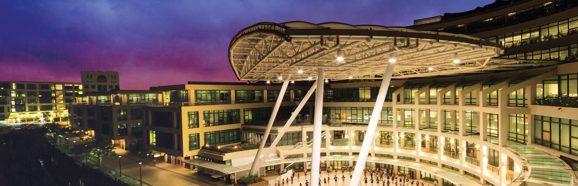
MAPS OF THE UNIVERSITY CAMPUSES 校園地圖
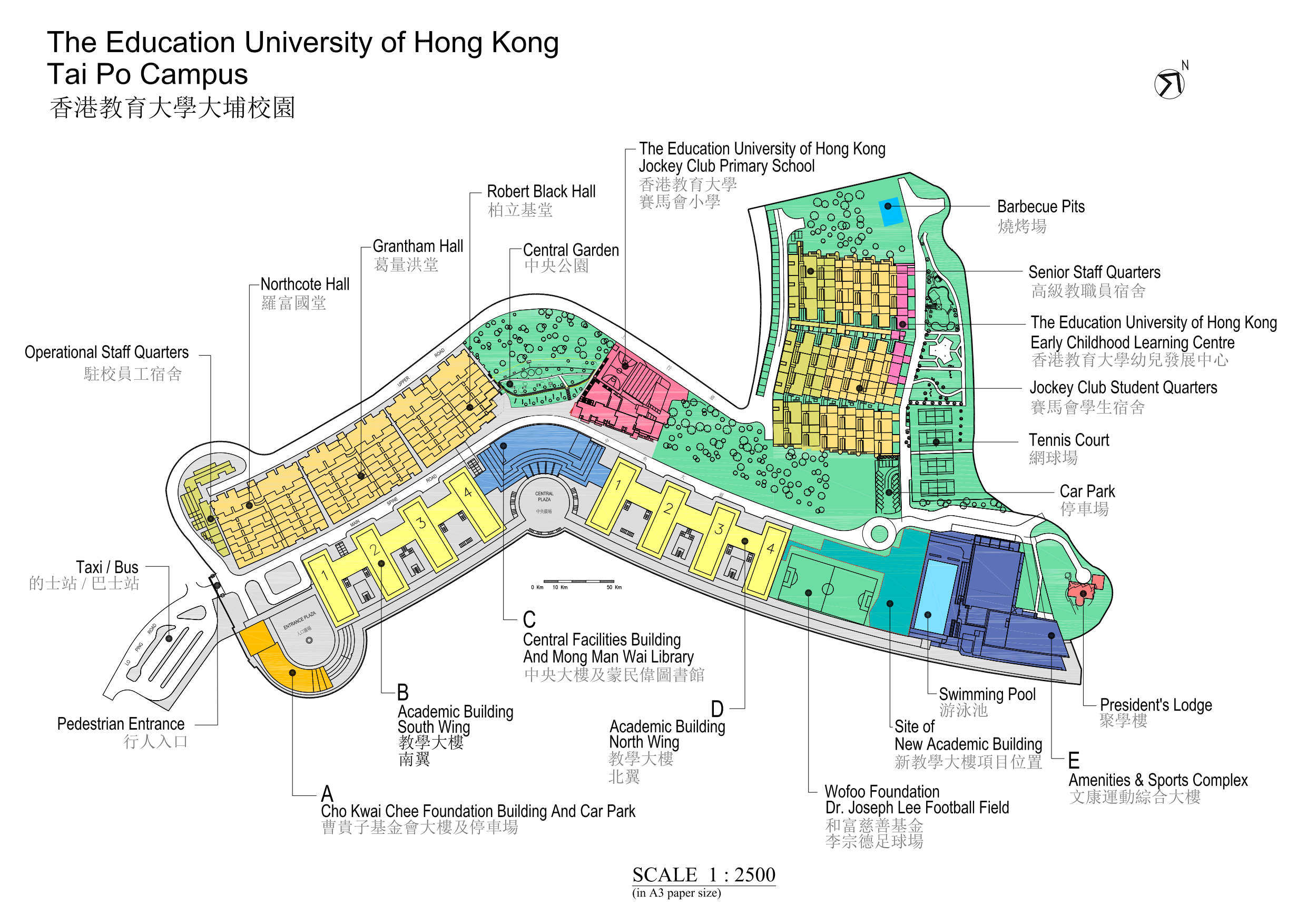
| Cho Kwai Chee Foundation Building (CKCF Building) (曹貴子基金會大樓)
|
|
Academic Building - South Wing (Block B) (教學大樓—南翼)
|
|
Central Facilities Building (Block C)(中央大樓)
|
|
Academic Building - North Wing (Block D)(教學大樓—北翼)
|
|
Amenities and Sports Complex (Block E)(文康運動綜合大樓)
|
Location Map of EdUHK 香港教育大學位置圖
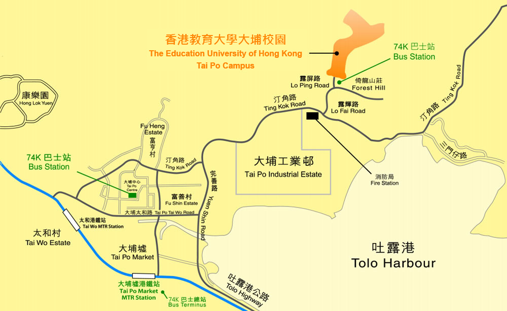
| 地址: | 香港新界大埔露屏路十號 |
| Address: | 10 Lo Ping Road, Tai Po, New Territories, Hong Kong |
| 公共交通: |
|
| Public Transport: |
|
| 穿梭巴士服務: |
|
| Shuttle Bus Services: |
|
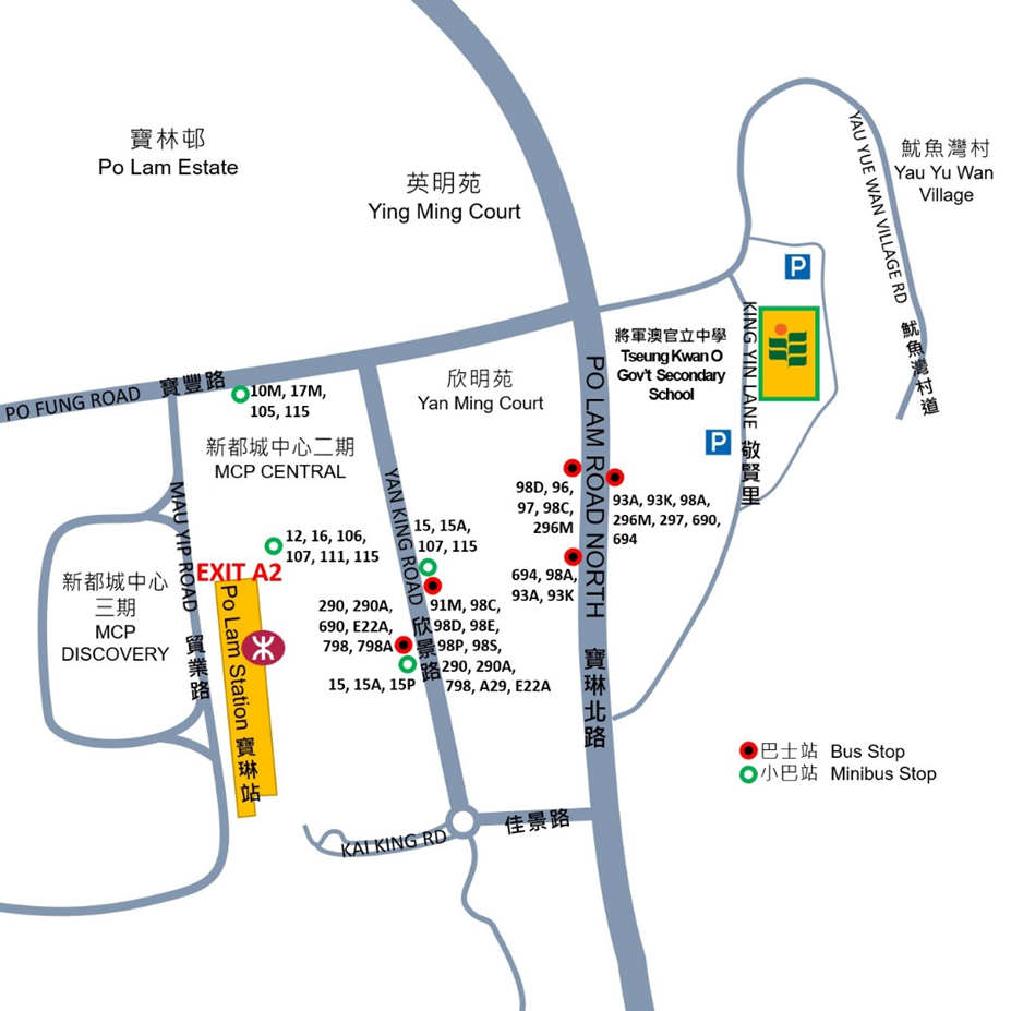
Location Map of the Study Centre in Tseung Kwan O 將軍澳教學中心位置圖
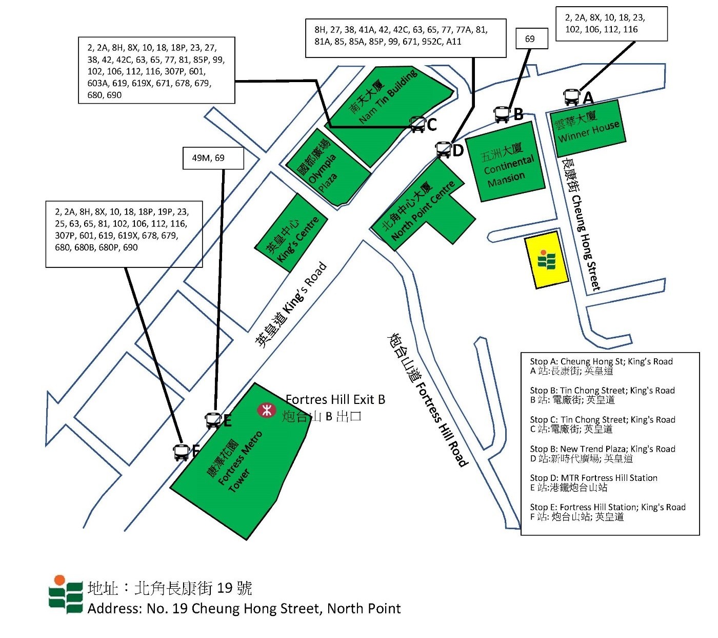
Location Map of the Study Centre in North Point 北角教學中心位置圖
Location Map of the Study Centres at Xiqu Centre & M+ Building in West Kowloon Cultural District 戲曲中心及M+之教學中心位置圖
九巴路線KMB Routes
215X, 261B, 281A, 8, 11, 203E, 280X, 900, 904, 905, 914, 930, 930X, 934, 936, 948, 952, 960, 961, 962X, 967, 968, 968X, 969, 970, 970X, 971, 978, A10, A12, A17, E11, E11A, E11B, P960, P968
專線小巴路線GMB Routes
26、74、74S、77M